

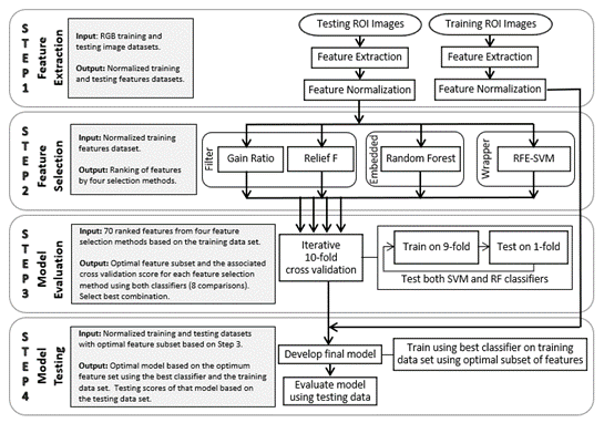
The goal of the project is to estimate crop residue cover from the high-resolution RGB images with different GSDs using machine learning algorithms.
United States Department of Agriculture (USDA) Natural Resources Conservation (NRCS) under Award Number NR186424XXXXC032
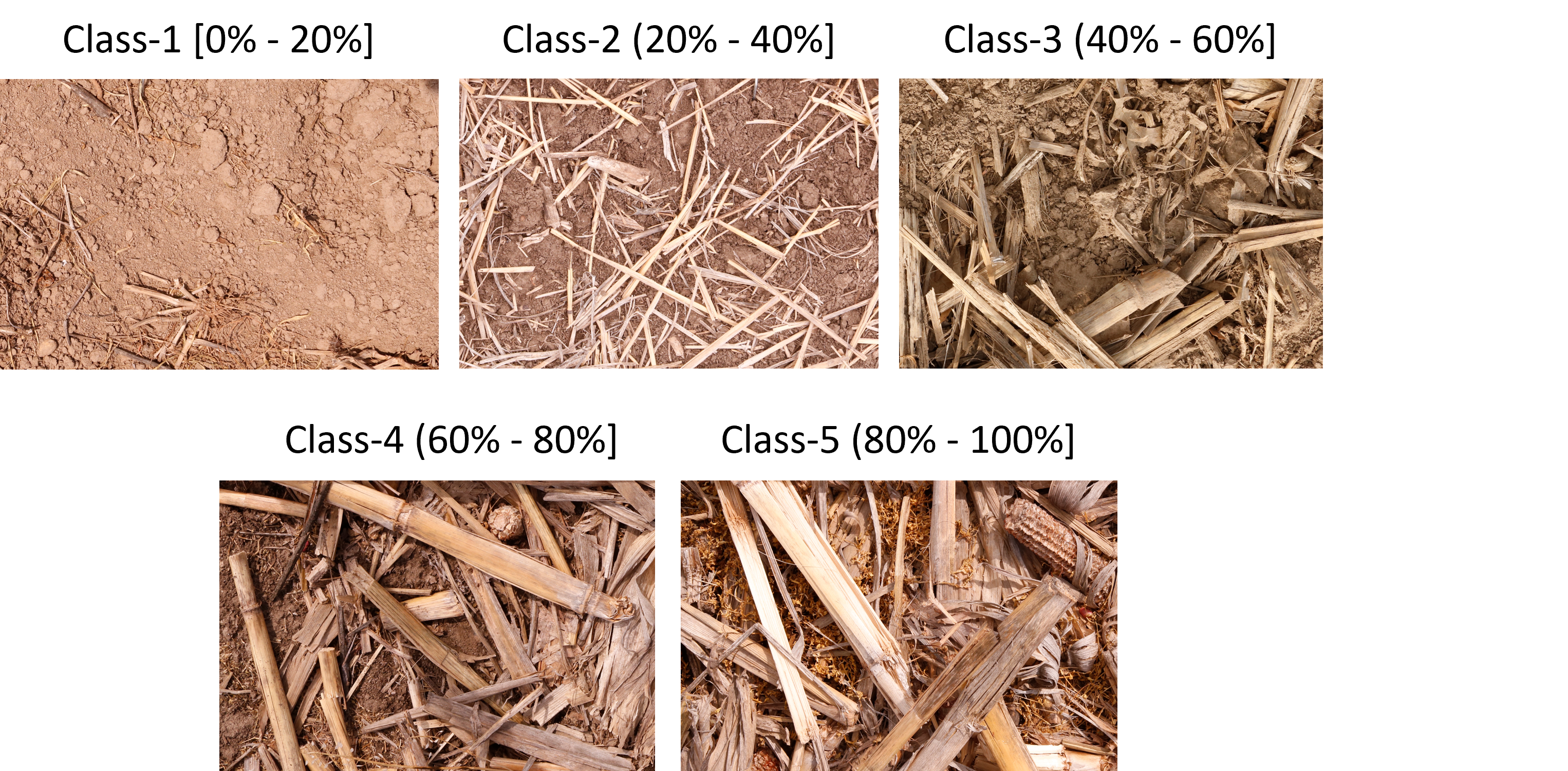
Imagery used in this project was collected as part of an associated project. Imagery used in this project was obtained from 40 Missouri row-crop fields between early May and early July of 2018 and 2019). Imagery was collected from multiple locations in each field, actively seeking locations in each field respresenting different residue conditions. Ultimately, imagery from one to four locations in each field was retained for use in this project to provide a diverse range of residue types and residue coverage. The final dataset included 88 field locations, 60 field locations in 2018 (32 planted to corn and 28 planted to soybean) and 28 field locations in 2019 (6 planted to corn and 22 planted to soybean).
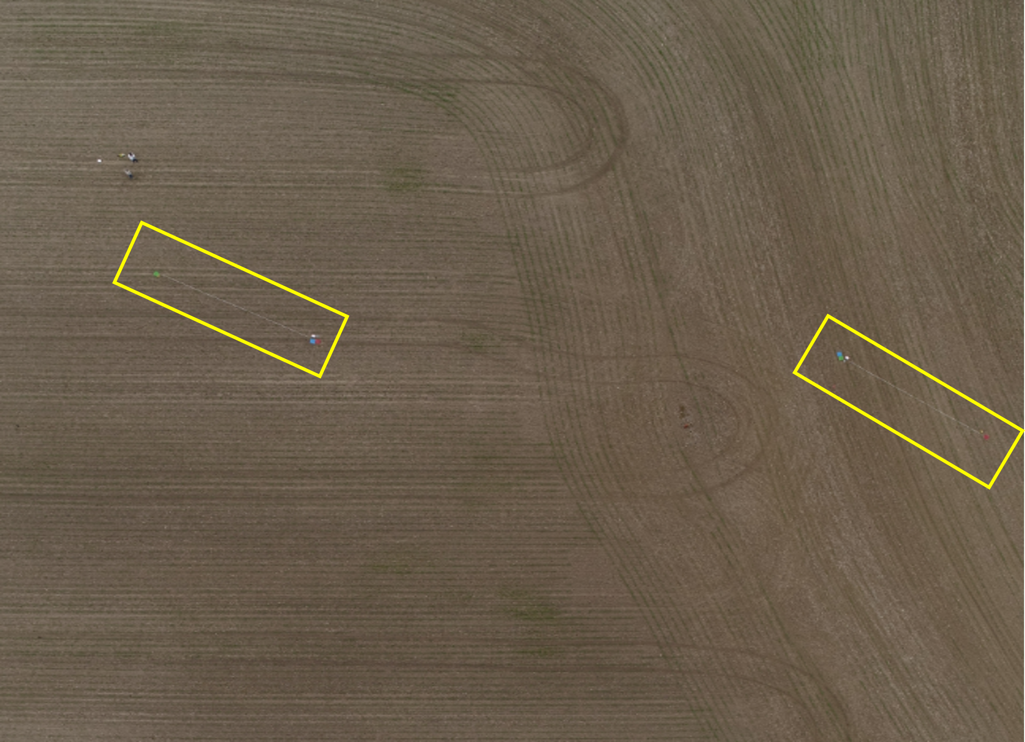
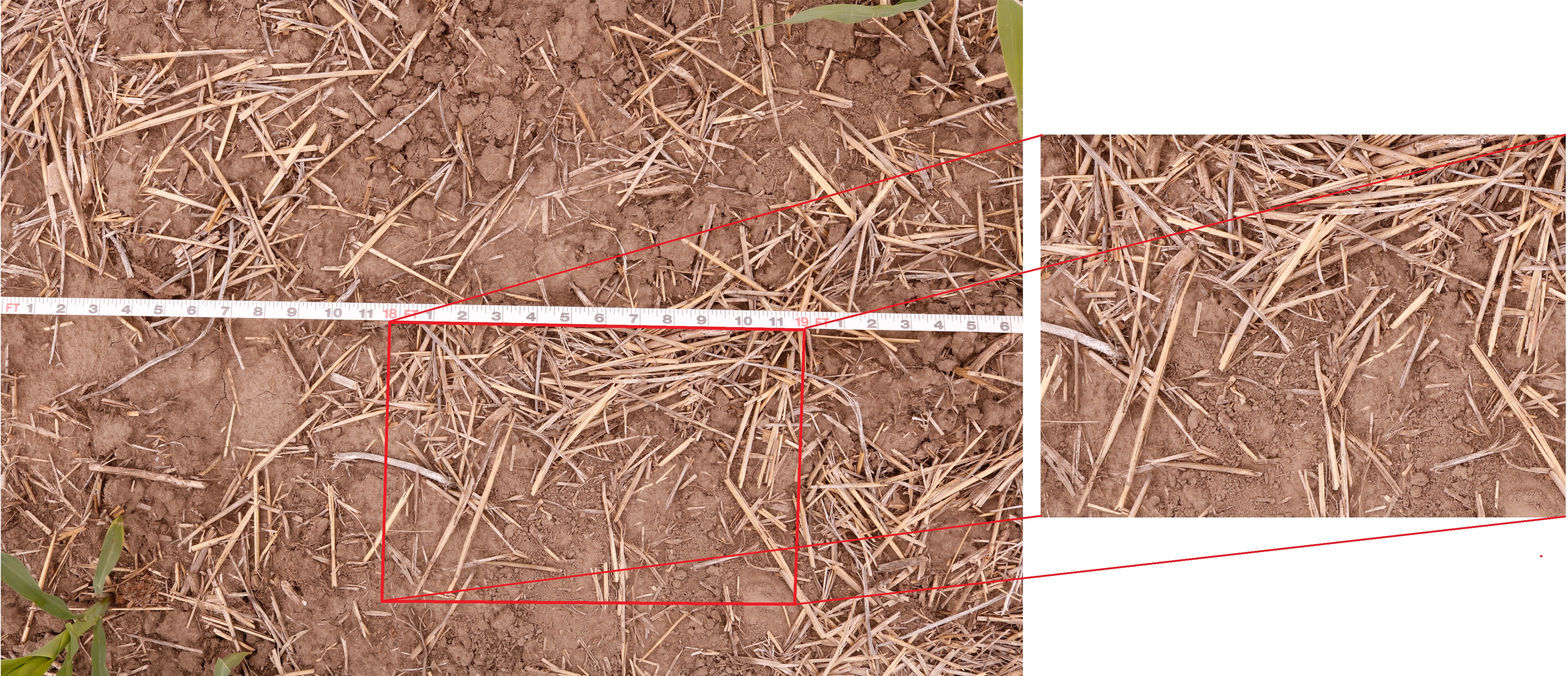
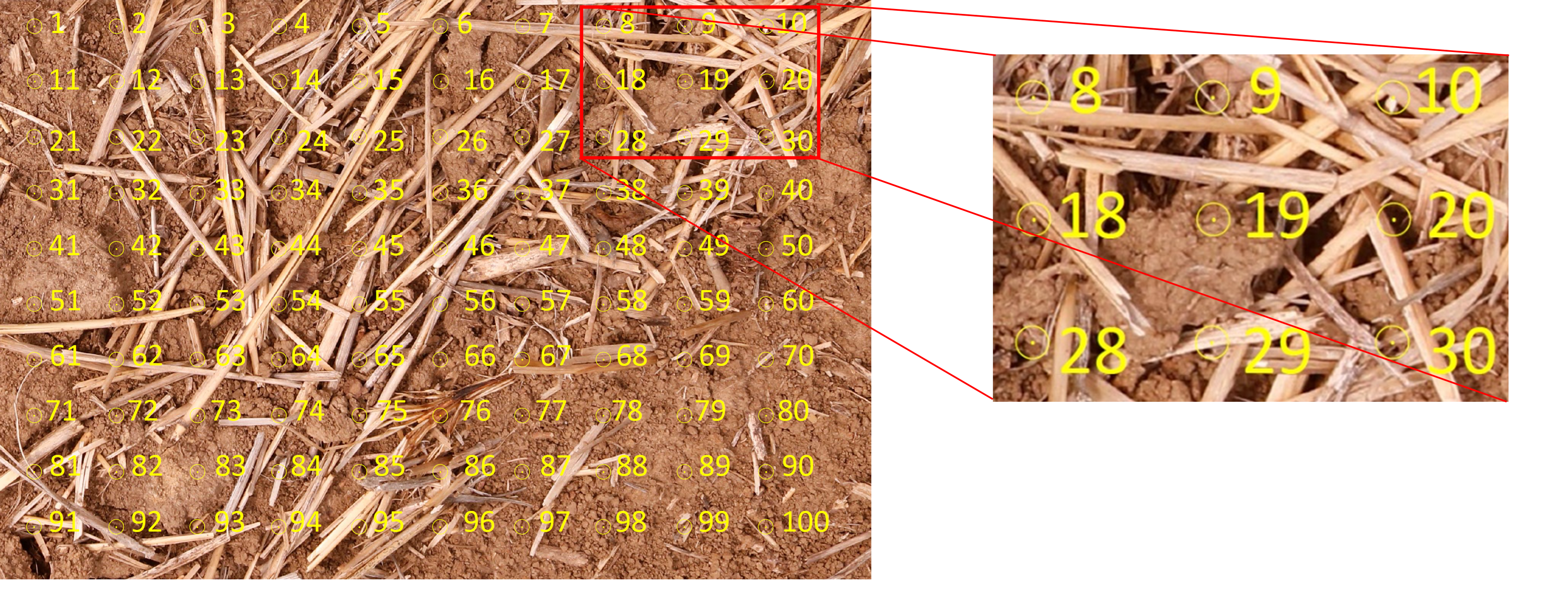
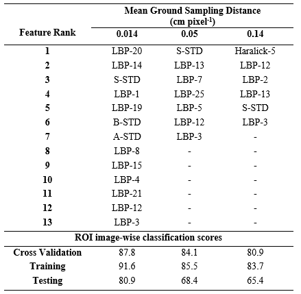
At each of the 88 field locations, a 15.24-m tape was placed at 45 degrees to the planted row direction. Three sets of images were then obtained of each tape. The first set of images were obtained at 1.0-m above the ground surface on a tripod-mounted Canon (Canon USA, Melville, NY) EOS Rebel T6i Digital single lens reflex (DSLR) camera equiped with a 24 mm stepper motor technology lens. Estimated GSD for these images was 0.014 cm pixel-1. The second and third sets of images were obtained at 2- and 5-m using DJI Phantom 4 PRO UAV (DJI, Shenzhen, China) including a camera with a 24-mm lens and a sensor with 20 MP resolution. Estimated GSD of the 2-m images was 0.05 cm pixel-1 and 5-m images was 0.14 cm pixel-1. The region of interest (ROI) images were cropped from the collected larger images using the software package Adobe Photoshop (Adobe Inc., San Jose, CA). Each cropped ROI image contained approximately 2,400 x 1,600, 610 x 410 or 220 x 150 pixel area (approximately 0.305-m x 0.020-m surface area of the soil) for 0.014, 0.05 and 0.14 GSD images, respectively. A bullseye grid method as per Lory et al.(2021) with n=100 grid points was used on 0.014 GSD images2. The ground-truth determined on the 0.014 GSD was then assigned to associated 0.05 and 0.14 GSD cropped ROI images that shared the same surface area of the soil.
1 PC Upadhyay, JA Lory, GN DeSouza, TAP Lagaunne, and C Spinka. Classification of crop residue cover in high resolution rgb images using machine learning. submitted for publication.
2 JA Lory, P Upadhyay, TAP Lagaunne, C Spinka, R Miller, G Davis, and GN DeSouza. Capability of high-resolution rgb imagery to accurately document residue in row-crop fields. Journal of Soil and Water Conservation, 2021.
We appreciate your interest in our research. By downloading the crop residue dataset, you and/or your research group are agreeing to cite our crop residue dataset and the associated paper(s) in any form of publication produced by you/your group using the same dataset.
A separate request must be made from any members outside your research group or institution.
By downloading the code for crop residue estimation, you and/or your research group are agreeing to cite our crop residue code and the associated paper(s) in any form of publication produced by you/your group using the same code.
A separate request must be made from any members outside your research group or institution.